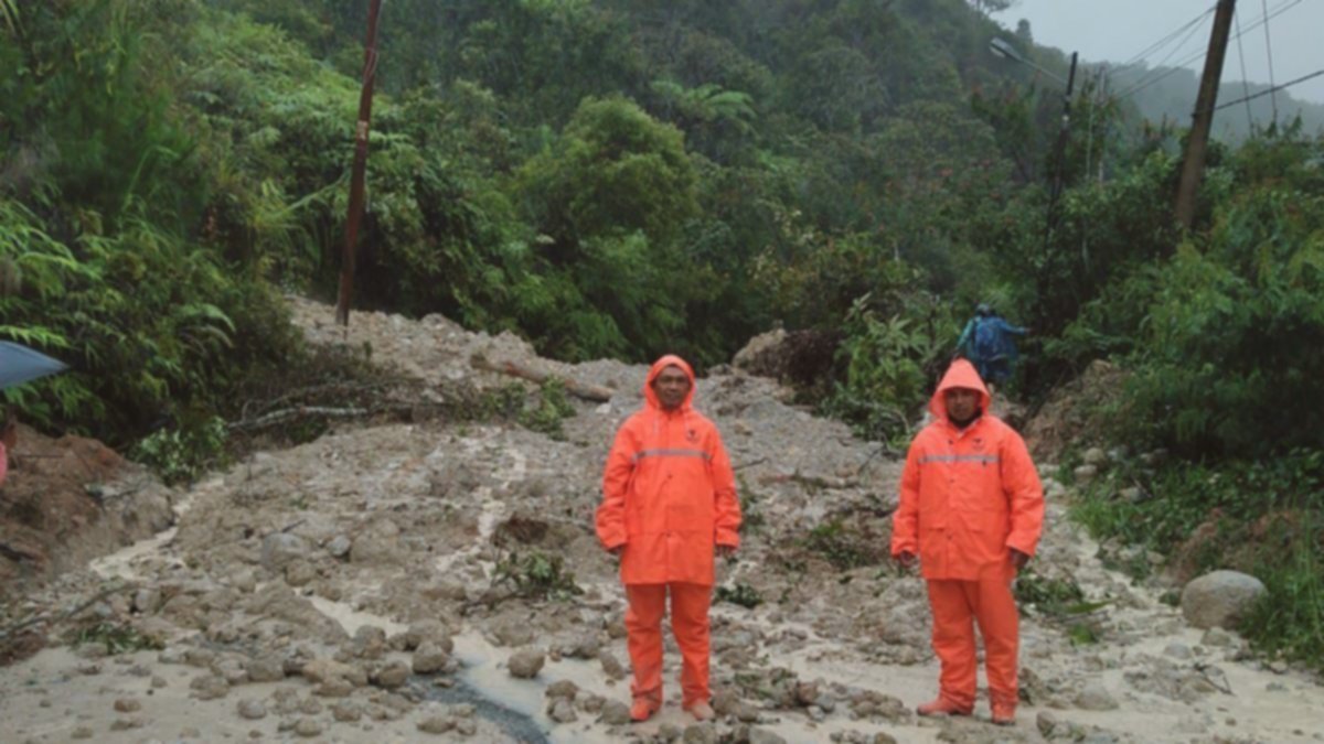

A devastating combination of flash floods and landslides has forced at least 2,851 people from their homes across four districts and cities in North Sumatra since late November 24. Residents in the affected areas describe the scale of this natural disaster as unprecedented, having not witnessed anything similar in decades.
Tragically, the confirmed death toll has reached 19 individuals, with casualties reported in the regencies of Tapanuli Tengah, Tapanuli Selatan, Tapanuli Utara, and the city of Sibolga. These figures, compiled by the National Disaster Management Agency (BNPB) and the National Search and Rescue Agency (Basarnas), are anticipated to rise as search and rescue operations persist amidst challenging conditions.
According to the BNPB, the severe floods and landslides were triggered by Tropical Cyclone KOTO, which developed in the Sulu Sea, and Cyclone Seed 95B, detected in the Malacca Strait. These two weather systems are cited as the primary cause of the intense rainfall and strong winds that battered the North Sumatra region.
However, environmental advocacy group Walhi (Wahana Lingkungan Hidup Indonesia) offers a starkly different perspective, asserting that the disaster cannot be separated from extensive “forest degradation.” They point to massive logging activities and gold mining operations carried out by PT Agincourt Resources as significant contributing factors.

BBC News Indonesia made a direct request to PT Agincourt Resources, the company holding the concession for the Martabe gold mine, for a response to Walhi’s allegations. Despite the urgency of the matter, the company did not provide any comment regarding the accusations.
Amidst the unfolding crisis, approximately 50 individuals were reported to be stranded deep within a forest in Hutanabolon Village, Tukka District, Tapanuli Tengah. A harrowing account of their plight was shared with BBC News Indonesia by a relative of those who sought refuge in the dense forest.
Since Tuesday, November 25, telecommunication networks across all four disaster-hit regions have been completely cut off, severing vital lifelines for communication and rescue efforts. A desperate plea was captured in the last video sent by evacuees from the Hutanabolon forest: “Mr. Mayor, please help us here. Landslides are on our left and right. There is no way out, Mr. Mayor.”
No More News from the Forest
Rose Zebua, living in Jakarta, last made contact with her relatives in Hutanabolon, Tapanuli Tengah, around 11 AM last Tuesday. On the other end of the line were her mother, two younger siblings, a three-month-old nephew, and other family members. They were in the forest, having fled the BNKP Hutanabolon Church – a displacement shelter they had occupied since November 22.
“They said that was the only path they could take because crossing the water was no longer an option,” Rose recounted. “So, they had to climb up a hill to save themselves, which is how they ended up on that mountain.”

The night before Rose’s family sought refuge in the Hutanabolon hills, they had just received aid from the Tapanuli Tengah Regency Government. The ceremony for the aid distribution was even posted on the local government’s social media accounts. In the uploaded photo, Rose’s mother was seen receiving rice, cooking oil, and instant food, her face stoic, eyes staring intently at the camera.
However, before Rose’s mother and her family could even utilize the much-needed supplies, they were forced to evacuate from the BNKP Hutanabolon Church once more. In their brief phone call, Rose’s family conveyed that they had carried nothing with them as they fled the onslaught of landslides and floods. “Only the clothes on their bodies, no food, no preparations whatsoever,” Rose expressed with despair.

A video sent by her relatives from the forest painted a grim picture: Rose’s family appeared drenched from the relentless heavy rain. Some wore raincoats, while others huddled for shelter under a tarp and an umbrella barely large enough for two adults. “We are in the middle of the forest,” a relative stated in the video, while another pleaded, “We are asking for help.” This phone call marked Rose’s last communication with her family, as the telecommunication network in the flood-affected area has remained severed, at least as of the time of this report. Overwhelmed by helplessness, Rose remains unsure if her family is still alive.
Rose contacted the BNPB contact center at 117, only to receive the disheartening response that “evacuation is underway, but hampered because transportation routes are cut off.”
“Never Happened Like This Before”
A similar tale of anxious searching comes from Tanti, a Jakarta resident, who lost contact with her mother, two siblings, and other extended family members in Sibolga City since Tuesday, November 25. The flash floods in Sibolga, among other sources, originated from a massive overflow of the Sipansihaporas Hydroelectric Power Plant Dam, located in Tapanuli Tengah but only about 11 kilometers from Sibolga city center.
When the floods struck last Tuesday morning, Tanti’s 67-year-old mother initially sought refuge at her son’s house. Being not far from the coast, her mother was confident that the floodwaters would not rise significantly in that residential area. Yet, during Tanti’s last communication with her mother, around 11 AM, she distinctly heard voices on the phone urging, “Come on, hurry.”

In less than three hours that morning, Tanti’s mother was forced to evacuate for a second time. However, Tanti remains agonizingly unaware of their current whereabouts or condition. “The phone lines are down,” Tanti stated, her voice heavy with worry.
For Tanti, the flash floods and landslides earlier this week were profoundly shocking. She believes her family in Sibolga shares the same sentiment. The reason, Tanti explained, is that Sibolga has never experienced a disaster of this magnitude – at least not since she was born some four decades ago. “Sibolga is a coastal area. It often rains heavily, but because it’s by the sea, the water easily drains into the ocean,” Tanti elaborated. “This week’s event was unforeseen: flash floods came from the mountains.”
What Caused This Disaster?
The extent of deforestation surrounding the flash flood-affected areas is exceptionally high, according to Rianda Purba, Executive Director of Walhi North Sumatra. Rianda bases his assertion on numerous videos circulating that vividly show tree trunks being swept away by the powerful floodwaters. “In Batang Toru District, the Batang Toru River overflowed. In its upstream regions, three water sources have already lost significant forest cover,” Rianda highlighted, attributing this to human activity.
Walhi explicitly accuses PT Agincourt Resources of being responsible for the rampant deforestation in Batang Toru. The company holds a 30-year concession for the Martabe mine, covering an expansive 130,253 hectares, which was issued by the government in 1997.

PT Agincourt Resources operates as a subsidiary of PT Danusa Tambang Nusantara, with the majority of its shares held by PT United Tractors Tbk. “In recent years, they have expanded their operational area,” Rianda noted. “Beyond damaging orangutan habitats, their activities clearly diminish the existing forest cover in the upper Batang Toru. We strongly suspect this is the primary cause of the current devastating floods,” Rianda asserted, drawing a direct link between mining expansion and the environmental catastrophe.

When BBC News Indonesia sought a response to these grave allegations from Katarina Siburian Hardono, Senior Manager of Corporate Communications at PT Agincourt Resources, she did not address the specific accusations. Instead, Katarina provided a written statement focusing on the company’s humanitarian efforts.
In her statement, Katarina affirmed that PT Agincourt Resources is actively assisting in the evacuation and displacement of residents affected by the floods and landslides. “Since the beginning of the incident, we have deployed our emergency response team, fully equipped with rubber boats and medical supplies to support evacuation processes and aid distribution,” she stated. “To ensure emergency services for the community, we have also established disaster management and health aid posts in Batu Hula and Sopo Daganak Villages, Batang Toru District. These posts provide rapid medical support, aid coordination, and other emergency necessities, including the distribution of food, ready-to-eat meals, mineral water, and medicines,” Katarina elaborated, detailing the company’s relief efforts.
BNPB’s Version of Disaster Triggers
Contrasting with Walhi’s claims, Abdul Muhari, Head of the Data, Information, and Communication Center of the BNPB, reiterated the official explanation for the disaster in the four North Sumatra regions. He stated that the events were triggered by Tropical Cyclone KOTO, developing in the Sulu Sea, and Cyclone Seed 95B, detected in the Malacca Strait. “These two weather systems influenced an increase in rainfall and strong winds across northern Sumatra,” Abdul clarified, pointing to meteorological phenomena as the root cause.
Abdul warned that North Sumatra is expected to experience continuous rainfall, which significantly elevates the risk of subsequent floods and landslides. As of now, electricity and telecommunication networks remain cut off in Sibolga, Tapanuli Tengah, Tapanuli Selatan, and Tapanuli Utara, exacerbating the isolation of these regions. Sibolga and Tapanuli Tengah are particularly isolated due to the extensive impact of the floods and landslides, Abdul noted. Even evacuation teams deployed via sea routes have been obstructed by extreme weather and high waves, further complicating rescue efforts.
As of mid-week, Abdul indicated that Cyclone Seed 95B still holds the potential to trigger moderate to heavy rainfall in Aceh, North Sumatra, West Sumatra, and Riau. Specifically for Aceh and North Sumatra, Abdul cautioned that the rain would be accompanied by strong winds, signifying an ongoing threat. For further insights into similar environmental challenges across the archipelago, consider reading:
- Belasan orang tewas dan delapan lainnya hilang akibat banjir dan longsor di Nduga, Papua
- Banjir terjadi setiap hari di berbagai daerah di Indonesia, ‘kebijakan pemerintah hangat-hangat tahi ayam’
- Tim SAR: 27 orang masih dalam pencarian akibat longsor di Banjarnegara, dua meninggal
Summary
Devastating flash floods and landslides have impacted four districts and cities in North Sumatra since November 24, displacing over 2,851 people and causing at least 19 confirmed deaths. The National Disaster Management Agency (BNPB) attributes these events to intense rainfall and strong winds triggered by Tropical Cyclone KOTO and Cyclone Seed 95B. In contrast, environmental group Walhi asserts that the disaster is linked to extensive “forest degradation” from massive logging and gold mining by PT Agincourt Resources. Telecommunication networks have been cut off in the affected areas, severely hindering communication and rescue operations.
Walhi specifically alleges that PT Agincourt Resources’ expanded mining operations are responsible for significant forest cover reduction in upstream areas like Batang Toru, contributing to the floods. PT Agincourt Resources did not address these accusations directly but instead detailed their humanitarian aid efforts, including deploying emergency teams and establishing health posts. Rescue efforts remain hampered by cut transportation routes and extreme weather, with warnings of continued heavy rainfall and strong winds for the region.